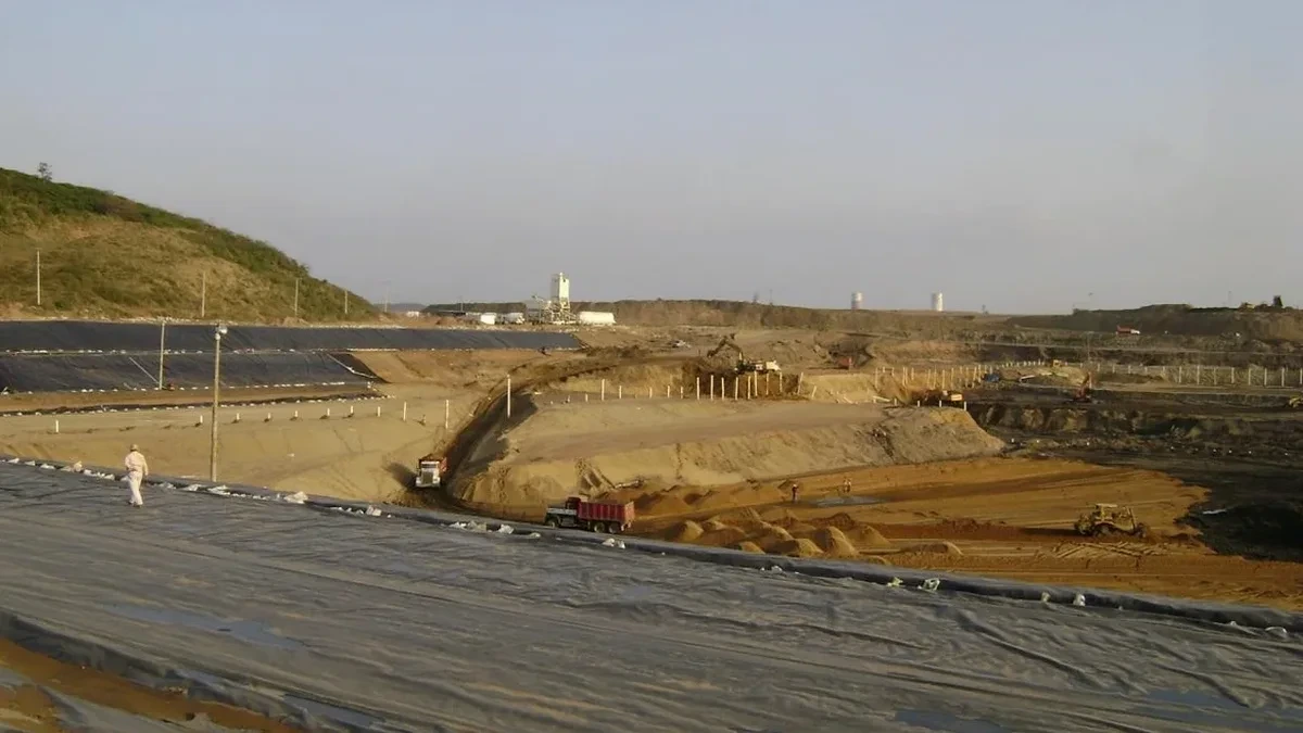
The most persistent mistake we encounter in Worcester is treating a deep excavation in glacial till the same way you would in Boston blue clay. A contractor mobilizes a standard soldier pile and lagging system, hits a dense lodgement till lens at 18 feet, and suddenly the H-piles refuse before reaching design tip elevation. Production stops. The site on Chandler Street sits idle while a redesign gets rushed through. Worcester’s subsurface — a chaotic mix of ablation till, outwash sands, and discontinuous hardpan — demands a site-specific geotechnical model developed from high-quality in-situ data, not a generic assumption pulled from a regional report. When the excavation exceeds 15 feet in downtown Worcester, groundwater perched on the till interface becomes the controlling factor for base stability. We combine CPTu pore pressure dissipation tests with laboratory triaxial shear strength measurement to define the drained and undrained parameters the shoring designer actually needs. The difference between a design that works and one that fails is often how well the geotechnical report captures the transition zones between the upper weathered till and the underlying competent formation.
In Worcester's glacial terrain, the critical design case for deep excavations is rarely the soil strength — it is the perched groundwater that saturates the till interface and collapses apparent cohesion.
Site-specific factors
A specialty drill rig arrives on site in Worcester equipped with a hollow-stem auger and an automatic SPT hammer calibrated to 60% energy efficiency. The crew sets up over a borehole location that has been cleared of underground utilities through Dig Safe Massachusetts. As the auger advances through the urban fill, the driller watches the torque gauge climb when the flights encounter a buried granite curbstone — one of hundreds that still lie beneath Worcester streets from the city's 19th-century infrastructure. The Standard Penetration Test is performed at 2.5-foot intervals through the till, with split-spoon samples recovered in brass liners and sealed for moisture content determination. When the borehole reaches the design depth, an observation well is installed with a screened interval targeting the perched water zone. The data from this investigation feeds directly into the finite element model that will predict wall deflections and ground loss. Skipping even one borehole because the site is tight creates a blind spot in the stratigraphy that can translate into a shoring failure costing ten times what the investigation would have cost. In downtown Worcester, where property lines are measured in inches and adjacent foundations date to the 1880s, the margin for error in excavation design is effectively zero.
Quick answers
What is the typical cost range for geotechnical design of a deep excavation in Worcester?
For a comprehensive design package covering subsurface investigation, laboratory testing, numerical modeling, and shoring design for a typical Worcester excavation (15 to 30 feet deep in urban conditions), budgets generally range from US$2,080 to US$7,300 depending on project complexity, number of boreholes, and instrumentation requirements. Projects requiring 3D finite element analysis or involving complex groundwater control fall toward the upper end.
How do Worcester's glacial soils affect deep excavation design compared to other parts of Massachusetts?
Worcester sits on a complex glacial sequence dominated by ablation till, lodgement till, and ice-contact stratified deposits. Unlike the marine clays of Boston, Worcester's tills are overconsolidated and generally provide good stand-up time, but they contain discontinuous sand lenses and perched groundwater that create localized instability. The transition from till to bedrock is highly irregular, with weathered zones that can be mistaken for competent rock. These conditions require more boreholes per unit area than a comparable site in eastern Massachusetts.
What design methods do you use to predict wall deflections?
We use beam-on-elastic-foundation models (PYWall or similar) for preliminary sizing, then refine the analysis with 2D finite element models in PLAXIS using the Hardening Soil with small-strain stiffness constitutive model. This captures the nonlinear stress-strain behavior of Worcester till at very small strains, which is critical for realistic deflection predictions. For excavations with complex geometry or corner effects, we employ 3D models to capture the arching that reduces loads near corners.
How do you address the risk of damaging adjacent historic buildings during excavation?
Worcester has a large inventory of unreinforced masonry buildings from the late 19th and early 20th centuries. We begin with a detailed condition survey and crack documentation of all structures within the zone of influence, typically twice the excavation depth. The design then limits predicted ground movements to thresholds compatible with the building's assessed fragility. During construction, we monitor with optical prisms and crack gauges, with predefined alert and alarm levels that trigger contingency measures such as compensation grouting if movements approach the design limit.